The 28 site analysis plates
How the set of 28 plates is composed for a site in the Netherlands, what each plate shows, which register it comes from and its limits.
Updated 15 October 2026This page was written by AI.
Overview
sitedia draws up to 28 analysis plates for a site in the European Netherlands. Each plate answers one question that comes up when a site is reviewed or presented. The set is the same as in the Korean edition; the data behind it are Dutch national registers (BAG, BGT, Kadaster, AHN4), 3DBAG and, for walking and public transport, OpenStreetMap.
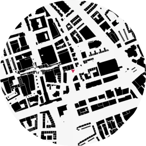
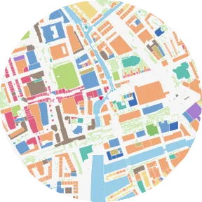
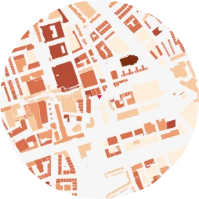
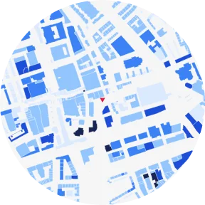
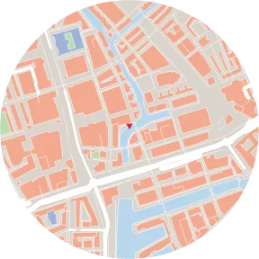
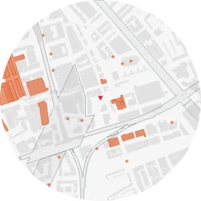
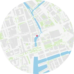
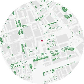
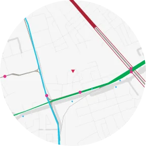
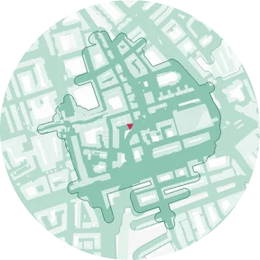
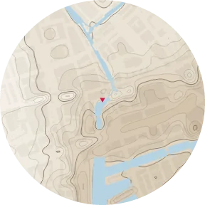
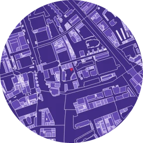
Examples above: Stadsdriehoek, Rotterdam, 500 m radius.
List of plates
Planning
| Plate | What it shows | Used for |
|---|---|---|
| ZONING PLAN (REFERENCE) | Main zoning (enkelbestemming) of the legacy bestemmingsplannen in force at the site, plus function areas from the new part of the omgevingsplan where a municipality has one. 23 classes and «No digital plan» (hatched) | Seeing the zoning pattern around the site; reference only |
| HERITAGE & DESIGNATIONS | Protected townscapes, UNESCO World Heritage, national monuments and archaeological monuments (RCE), Schiphol restrictions (LIB), noise, safety, safeguarding and environmental zones from the plans | Checking heritage and statutory zones before massing |
| PUBLIC FACILITIES | Traffic, green space, community (schools, care, civic) and sport zoning, plus amendment, elaboration and exemption areas from the plans | Seeing which public land and future plan changes surround the site |
Buildings
| Plate | What it shows | Used for |
|---|---|---|
| BUILDINGS | BAG building outlines (figure-ground), one colour | Reading the grain of the fabric |
| BUILDING USE | BAG use (gebruiksdoel) in 12 classes plus Outbuilding (no unit) and Unknown | Seeing where uses mix and where one use dominates |
| BUILDING AGE | BAG year built (bouwjaar) in 6 bands: before 1900, 1900–1939, 1940–1959, 1960–1979, 1980–1999, since 2000 | Reading development history |
| BUILDING HEIGHT | 3DBAG height in 5 bands | Seeing the mid-rise range |
| HIGH-RISE / LOW-RISE | Two plates, each with one height threshold that you set | Basis for a height strategy |
Surroundings and access
| Plate | What it shows | Used for |
|---|---|---|
| GREEN SPACE & WATER | Woodland, tree belts and shrubs (BGT), green space and low vegetation, waterways and water bodies, sea | Open space the site can connect to |
| TREES | Trees detected from the 2025 near-infrared aerial photo and AHN4 heights: individual trees and continuous canopy | Street and park tree distribution |
| ROADS | Streets by hierarchy, from motorways to footways and cycle paths | Access and the street the site fronts |
| CHOICE | The darker the street, the more often it lies on routes through the area. It is worked out from the street layout alone, not from counts of people or vehicles. | Picking the street for the main entrance or ground-floor shops (where people pass) |
| STREET ENCLOSURE | Street width (D) ÷ height of the buildings on both sides (H). Darker streets are narrow and lined with tall buildings; lighter ones are open. | Street sections (building height, setbacks): spotting streets that feel too closed or too open |
| PUBLIC TRANSPORT | Train and metro stations, tram and bus stops and rail lines (OpenStreetMap) | Station proximity and walking routes |
| WALKING DISTANCE | How far you get on foot in 5, 10 and 15 minutes along streets and paths (OpenStreetMap network) | The real walking reach instead of a circle |
| CITY BLOCKS | Blocks enclosed by streets, with water and tunnels removed | Block size and permeability |
Ground and parcels
| Plate | What it shows | Used for |
|---|---|---|
| TERRAIN & CONTOURS | AHN4 ground height relative to NAP, with contours every 0.5 m or more (chosen from the relief) | Dykes, canal banks and raised ground |
| SLOPE | Slope in 6 bands with limits at 0.5, 1, 2, 3 and 5° | Finding the few slopes in flat country |
| ASPECT | Which way the slopes face. South-facing slopes get more sun; north-facing ones are shadier. Strong colours are steep, pale colours gentle, and unshaded areas flat. | Layout and planting: south-facing slopes get sun, north-facing ones shade |
| CADASTRAL PARCELS | Kadaster cadastral map, parcel outlines | Reading the ownership grain |
| PLOT SIZE | The same parcels coloured by area in 5 bands (100 · 300 · 1,000 · 3,000 m²) | Where land is finely divided |
Environment and density
| Plate | What it shows | Used for |
|---|---|---|
| SUN HOURS | Hours of direct sun on the ground on the winter solstice (shadows every 10 minutes, summed) | Which ground gets winter sun |
| SKY VIEW (SVF) | Share of sky visible from the ground (0–100%) | Telling enclosed from open ground |
| VISIBILITY | Where a building on the plot would be seen from the street. Dark areas see it even if it is low; light areas only if it is tall. Unshaded areas do not see it even at the top height band. | Height studies and townscape review: how tall to build to be seen from where |
| WIND ROSE | Annual wind frequency and speed in 16 directions from the nearest TMYx weather file (2011–2025) | Orientation decisions |
| AERIAL PHOTO | Current PDOK aerial photo (8 cm, Beeldmateriaal.nl) in the plate frame | Checking the abstract plates against the ground |
| DENSITY | Heat map of estimated floor area or building count | Where development is concentrated |
Reading an empty or grey plate
| State | Meaning |
|---|---|
| Hatched «No digital plan» on ZONING PLAN | No legacy plan in the national copy at that spot. That does not mean no rules apply |
| Grey «Unknown» on BUILDING USE | The BAG has no use for the building, or the building has no dwelling or other unit (outbuildings are a separate class) |
| Building without height | Not yet in 3DBAG (finished after the last survey); see BAG and 3DBAG |
| SLOPE almost one colour | Normal in flat parts of the Netherlands; most ground is under 0.5° |
Limitations
- Zoning is for reference only. The rules in force are in the municipality's omgevingsplan (Regels op de kaart)
- Use is the registered use in the BAG, not the use on site today
- Heights come from 3DBAG. Buildings finished after 2022 may have no height yet
- WALKING DISTANCE is an estimate at 80 m per minute; crossings, bridges that open and waiting times are not modelled
- SKY VIEW includes buildings only. SUN HOURS includes buildings and terrain, not trees
- Coverage: the European Netherlands only
Related guides
- How to draw a site analysis diagram
- BAG and 3DBAG
- Zoning plan and omgevingsplan
- AHN4, NAP and contours
- Data sources
© sitedia · Home · About · All guides · Pricing ·
Terms · Privacy · Contact · Data sources ·
Other editions: Korea · United States · Japan · Spain · United Kingdom
Example plates: BAG (Kadaster, CC0) · © 3DBAG by tudelft3d and 3DGI (CC BY 4.0) · BGT, NWB, AHN4 (CC0) · Kadaster, Beeldmateriaal.nl, PDOK (CC BY 4.0) · © OpenStreetMap contributors (ODbL)
Example plates: BAG (Kadaster, CC0) · © 3DBAG by tudelft3d and 3DGI (CC BY 4.0) · BGT, NWB, AHN4 (CC0) · Kadaster, Beeldmateriaal.nl, PDOK (CC BY 4.0) · © OpenStreetMap contributors (ODbL)