Zoning plan and omgevingsplan on the plates
What the ZONING PLAN (REFERENCE), HERITAGE & DESIGNATIONS and PUBLIC FACILITIES plates draw, how legacy plans and the new omgevingsplan are combined, and why the result is for reference only.
Overview
Since 1 January 2024, under the Environment and Planning Act (Omgevingswet), each municipality has one omgevingsplan (environment plan) with the rules in force. Most of it is still the temporary part: the legacy zoning plans (bestemmingsplannen) made under the old Spatial Planning Act (Wro). Where a municipality has rewritten an area in the new part, that part replaces the legacy plan there.
The ZONING PLAN (REFERENCE) plate combines both:
- The legacy Wro plans (IMRO) from the national copy on PDOK (dataset «Ruimtelijke plannen», snapshot 1 July 2026)
- For each site, the current plan status from the DSO-LV API «Ruimtelijke plannen opvragen»: plans adopted after the copy are added, lapsed plans removed. The DSO-LV is the national system that also feeds Regels op de kaart (Omgevingsloket)
- Function areas (gebiedsaanwijzingen of type functie) from the new part of the omgevingsplan, fetched per site from the DSO-LV APIs «Omgevingsdocumenten presenteren» and «Geometrie opvragen». Where they exist, they replace the legacy plan on the plate at that spot
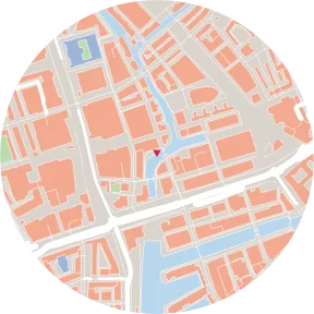
Reference only. The rules in force are in the municipality's omgevingsplan: check Regels op de kaart (Omgevingsloket). Legacy plans can be incomplete or out of date. A hatched area («No digital plan») does not mean that no rules apply; the plan may exist as a document only.
Classes
The plate shows the main zoning (enkelbestemming) in 23 classes: Residential, Residential area, Mixed use, Town centre, Retail, Food & drink, Office, Services, Business, Business park, Community facilities, Culture & leisure, Sport, Recreation, Green space, Garden, Nature, Woodland, Agricultural, Agricultural with values, Traffic, Water, Other; plus «No digital plan» (hatched). Function areas from the new omgevingsplan (for example «Wonen en werken», «Wijkcentrum») are placed in the nearest class; the note on the plate gives their share of the circle.
HERITAGE & DESIGNATIONS
| Category | Source |
|---|---|
| Protected townscape (beschermd stads- of dorpsgezicht) | RCE |
| UNESCO World Heritage | RCE |
| National monument (rijksmonument) | RCE |
| Archaeological monument | RCE |
| Airport height restriction and other Schiphol limits (LIB) | Luchthavenindelingbesluit Schiphol (decision areas in the IMRO plan data) |
| Noise, safety, safeguarding, air traffic and environmental zones, other designations | Area designations (gebiedsaanduidingen) in the legacy plans |
Some Schiphol layers (radar, bird attraction, other LIB areas) are off by default and can be turned on.
PUBLIC FACILITIES
The Netherlands has no separate category of planned public facilities. The plate approximates it with the zoning for traffic, green space, community (schools, care, civic) and sport, plus amendment areas (wijzigingsgebied), elaboration areas (uitwerkingsgebied) and exemption areas (afwijkingsgebied) from the plans.
Site overview
For the site itself, the «Site overview» lists the zoning by share of the site, plan name and date, a link to the plan text, and the figures in the plan (maximum building height, eaves height, coverage, storeys, dwellings) where it has them. See Site overview.
Limitations
- The plates do not test a design against the rules and do not say what can be built
- Rules in the new omgevingsplan other than function areas (activities, norms) are not drawn
- Plans that exist only as documents have no digital zoning
Data sources
| Data | Licence |
|---|---|
| Legacy Wro zoning plans (IMRO), national copy via PDOK (dataset «Ruimtelijke plannen») | CC0 1.0 |
| DSO-LV: Ruimtelijke plannen opvragen, Omgevingsdocumenten presenteren, Geometrie opvragen | CC BY 4.0 |
| Rijksdienst voor het Cultureel Erfgoed (RCE) | CC BY 4.0 |
Related guides
Example plates: BAG (Kadaster, CC0) · © 3DBAG by tudelft3d and 3DGI (CC BY 4.0) · BGT, NWB, AHN4 (CC0) · Kadaster, Beeldmateriaal.nl, PDOK (CC BY 4.0) · © OpenStreetMap contributors (ODbL)