 Use USE
 Sun hours SUN HOURS
 Density DENSITY
 Age AGE
 Green space & water GREEN
 Roads ROADS


37.5636 N · 126.9850 E · r 500 m
Site
Search an address or click the map. Parcels and boundaries work too.
Placement or colour changed — click to update the panels.
Used for the 3D model and for ‘Proposed’ on the panels.
The uploaded file is deleted as soon as conversion ends, and the converted model is deleted from the server after 15 minutes. Recent models (up to 3) stay only in this browser and are deleted 7 days after you last used them. A reload clears them from the screen.
Site overview
Site area, zoning and limits for the chosen site, with figures for the area around it. Draw a section line on the plan in the Section tab below.
Diagrams
Recolour any panel; toggle use/age categories individually.
When you use these diagrams, include this line.
Analysis
3D massing, sun and shadow, wind, thermal comfort, sections, a context map and a 3D diagram for the same site and radius, and the plates combined into one.
3D massing, sun and shadow, wind, thermal comfort, section, context map, combined plates and 3D diagram need a large screen and run calculations, so they don't open on a phone.
- Address
- sitedia.app
- Site
Open this address on a computer, search the same site and make the diagrams.
Log in with the same account on your computer and it opens from ☆ My places.
Building mass
Uses the site, radius and shape picked above; clipped at the boundary.
Drag to orbit · wheel to zoom · right-drag to pan.
Colours and on/off by category
Change the position, height and rotation in the Site section above (map or 3D preview).
Placement or colour changed — click to update the panels.
Buildings with no height or floor count are not built, so the count is lower than the flat panels. More →
Sun & shadow
Sun path and shadows on the same model as the mass view. Build the mass first.
Your massing model isn’t included in the sun-hours and shadow-sweep calculations yet. It is included in the 3D shadows.
Calculation cells: sunlight hours 4 m (coarser above 1 km radius); sky view 4 m; shadow sweep 2 m. Pilotis and eaves are treated as solid down to the ground.
Drag to orbit · wheel to zoom · right-drag to pan.
Sun position is calculated from the site's latitude and longitude (GMT, no British Summer Time). Only standing buildings cast shadows — this is not a daylight and sunlight (BRE) assessment. More →
Wind
A wind rose for the nearest weather station — how often and how strongly the wind blows from each of 16 directions. These are observed frequencies, not a simulation.
Your massing model isn’t included in this calculation yet.
GPU lattice-Boltzmann (LES), prevailing direction only — an early-design reference, not a validated wind microclimate assessment. Terrain comes from elevation data; trees are not in the model, and buildings with no known height are left out.
Regional wind from a station several km away, not measured on this site — use it to read the prevailing direction and season. More →
Thermal comfort
UTCI — how hot it actually feels where a person stands. Air temperature and humidity come from the weather file, wind from our own simulation, and sun and shade from the building model.
Your massing model isn’t included in this calculation yet.
UTCI combines air temperature, humidity, wind and radiation into one felt temperature. 9–26 ℃ is comfortable; heat stress starts at 32 ℃.
Trees are assumed to be 8 m tall and pedestrian-level wind uses the 6 m value — compare places rather than quoting the numbers. More →
Section
Draw a section line on the plan to cut a section and skyline right below it. Vertical scale 1:1.
Click or drag on the plan to move the section line there.
Buildings cut by the lineBuildings behind (lighter = farther)GroundSite Building heights use the same data as the 3D massing · terrain from elevation data · nothing below ground (basements) is drawn.
Context map
An outline map of the surrounding buildings, with your diagram in the middle.
Drag on the map to draw · drag inside the frame to move it · drag a handle to resize · the dashed line is the widest it can go
Pick one colour; the 5, 10 and 15 min shades are set from it.
Combine plates
Pick from the plates drawn above and stack them into one flat plate. Save it as a PNG, or as an SVG with one layer per plate.
Only the bottom plate keeps its base disc; plates above are laid on without it, so lower plates show through. Raise the transparency of a plate that covers too much.
3D diagram
Turn it and save — the PNG or SVG comes out at the angle you are viewing. Heights are true to scale (1:1).
The ground is too flat here for three or more contour layers.
Buildings without a known height are drawn as footprints only.
Land cover map © Korea Ministry of Environment (KOGL Type 1)
Guides View all · FAQ
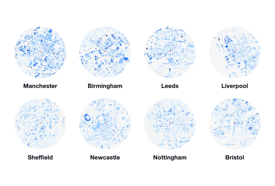 8 more cities in England
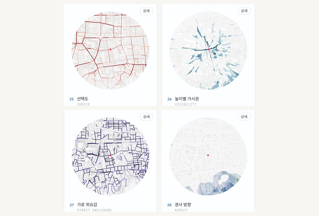 4 new plates
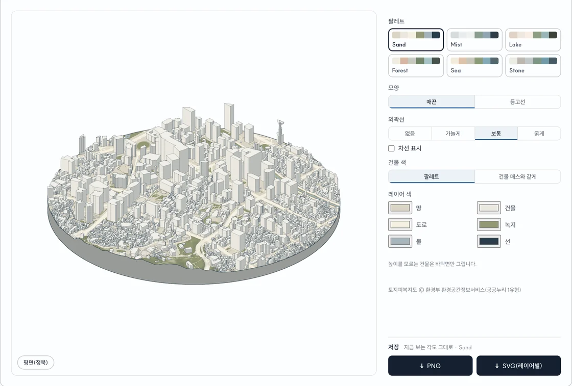 3D diagram update
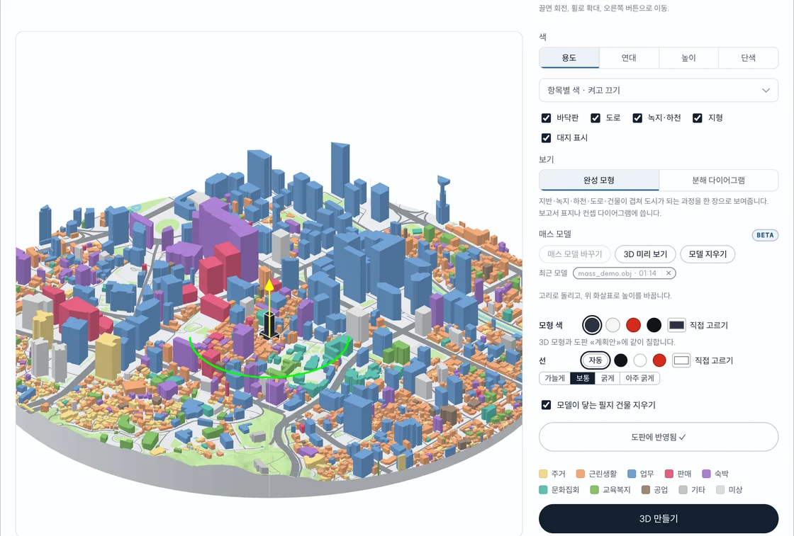 Upload a massing model (BETA)